
LAND LAW 2
- Teacher: Admin User
Definition:
A control survey is a type of survey carried out to establish reference points and lines with known positions and elevations that serve as a framework for other surveys, such as topographic, engineering, or construction surveys.
Essentially, it provides the geodetic or horizontal/vertical reference network upon which all other surveys rely.
Objectives / Purpose:
-
Establish accurate horizontal and vertical control points.
-
Provide a reference framework for mapping, construction, and design.
-
Ensure uniformity and accuracy in subsequent surveys.
-
Reduce errors in large-scale surveys by providing fixed benchmarks and reference lines.
-
Support engineering projects, land subdivision, and cadastral surveys.
Types of Control Surveys:
-
Horizontal Control Survey
-
Determines latitude, longitude, and positions of points on the ground.
-
Used to establish property boundaries, road alignments, and layouts.
-
-
Vertical Control Survey (Levelling)
-
Determines elevations of points relative to a reference datum.
-
Provides benchmarks for construction, flood control, and drainage projects.
-
-
Geodetic Control Survey
-
Uses triangulation, trilateration, or GPS to provide control over large areas.
-
Ensures high precision for mapping and national grids.
-
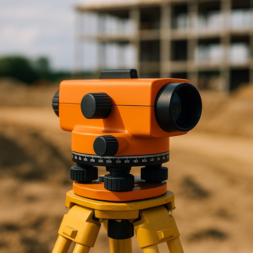
Instruments Used in Control Surveys:
-
Theodolite / Total Station: Measures angles and distances.
-
Auto Level / Dumpy Level: Measures elevations and benchmarks.
-
GPS / GNSS Receivers: Provides accurate positions globally.
-
Measuring tapes / EDM (Electronic Distance Meter): For baseline measurements.
Applications of Control Survey:
-
Provides framework for topographic and engineering surveys.
-
Establishes benchmark networks for construction projects.
-
Supports mapping, cadastral, and urban planning.
-
Ensures accuracy and consistency in large-scale surveying projects.
-
Used in road, railway, and pipeline alignment surveys.
- Teacher: Admin User
PHYSICAL GEOGRAPHY – Notes Format
Physical Geography is the branch of geography that deals with the natural features and processes of the Earth. It focuses on the physical environment, including landforms, climate, vegetation, soils, and water bodies.
- Teacher: Admin User
Introduction to Control Survey
Control surveying is the process of establishing a framework of accurately positioned reference points (called control points) on the ground. These points are used as a basis for all other types of surveys, such as topographic, boundary, engineering, and construction surveys.
It ensures that all survey work is referenced to a common, consistent coordinate system..
Introduction to Survey Instruments
Survey instruments are tools and devices used by land surveyors to measure, map, and analyze the Earth's surface. These instruments help collect data related to distances, angles, elevations, and positions. The data collected is used to create maps, determine boundaries, design infrastructure, and carry out construction projects.
Purpose of Survey Instruments
-
To ensure accuracy and precision in measurement.
-
To collect data for making maps, drawings, and plans.
-
To help in engineering, construction, land development, and geospatial analysis.
Categories of Survey Instruments
-
Angle Measuring Instruments
-
Theodolite
-
Total Station
-
-
Distance Measuring Instruments
-
Chain / Measuring Tape
-
EDM (Electronic Distance Measurement)
-
Total Station
-
-
Leveling Instruments
-
Dumpy Level / Auto Level
-
Digital Level
-
-
Positioning Instruments
-
GPS (Global Positioning System)
-
RTK (Real-Time Kinematic GPS)
-
-
Marking and Setting Out Instruments
-
Ranging Rods
-
Plumb Bob
-
Pegs and Stakes
-
-
Modern Digital and Aerial Survey Instruments
-
Drones (UAVs)
-
LiDAR Sensors
-
Photogrammetry Cameras
-
Importance of Using Proper Instruments
-
Increases efficiency and speed in fieldwork.
-
Reduces errors and mistakes.
-
Produces high-quality maps and plans.
-
Ensures legal accuracy in boundary surveys.
- Teacher: Admin User
SURVEY
1. What is a Topographical Survey?
A Topographical Survey (or Topo Survey) is a detailed survey that shows the natural and man-made features on a piece of land. It provides information about the location, height (elevation), size, and shape of these features.
This type of survey helps planners, engineers, and architects understand the physical characteristics of the land before construction, development, or land-use planning.
2. Objectives of Topographical Survey
-
To map land features: hills, rivers, trees, roads, buildings, etc.
-
To determine the contour (shape and slope) of the ground.
-
To prepare base maps for engineering and construction projects.
-
To assist in drainage, planning, and design of land use.
3. Instruments Used
| Instrument | Use |
|---|---|
| Total Station / Theodolite | Measuring angles and distances |
| Leveling Machine (Dumpy or Auto Level) | Determining height differences |
| Prism and Pole | Used with Total Station for measurements |
| GPS and RTK | Mapping coordinates and elevation |
| Compass | Orientation and direction |
| Tape Measure/Chain | Measuring small distances |
| Ranging Rods | Marking points during the survey |
- Teacher: Anitah Masai
- Teacher: Admin User